Lighthouse Reach day-use area
Enjoy boating from this picnic site on the northern end of the island that was once the site of a lighthouse.
Accessible by
- High clearance 4WD
- Boat
Attraction facilities
- Wood-fired barbecue (BYO wood)
- Picnic tables (some sheltered)
-
![There's an open, grassy area with plenty of shade.]() There's an open, grassy area with plenty of shade.
Photo credit: © MJL Photography
There's an open, grassy area with plenty of shade.
Photo credit: © MJL Photography
-
![Picnic under the shelter or in the shade of the eucalypt trees.]() Picnic under the shelter or in the shade of the eucalypt trees.
Photo credit: © MJL Photography
Picnic under the shelter or in the shade of the eucalypt trees.
Photo credit: © MJL Photography
-
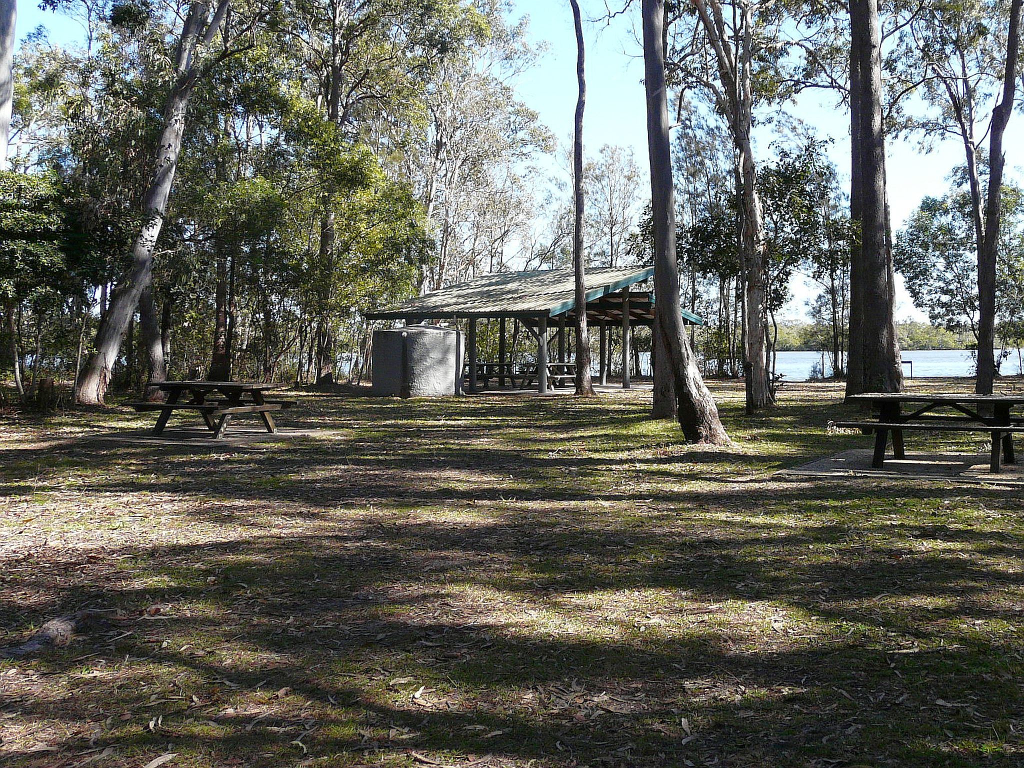
![The day-use area is on Pumicestone Passage and is surrounded by tall, shady trees.]() The day-use area is on Pumicestone Passage and is surrounded by tall, shady trees.
Photo credit: Leanne Siebuhr © Queensland Government
The day-use area is on Pumicestone Passage and is surrounded by tall, shady trees.
Photo credit: Leanne Siebuhr © Queensland Government
-
![Pull up in your boat and have a picnic.]() Pull up in your boat and have a picnic.
Photo credit: Rose Gray © Queensland Government
Pull up in your boat and have a picnic.
Photo credit: Rose Gray © Queensland Government
-
![Take the time to wander to the site of the old lighthouse.]() Take the time to wander to the site of the old lighthouse.
Photo credit: Rose Gray © Queensland Government
Take the time to wander to the site of the old lighthouse.
Photo credit: Rose Gray © Queensland Government
-
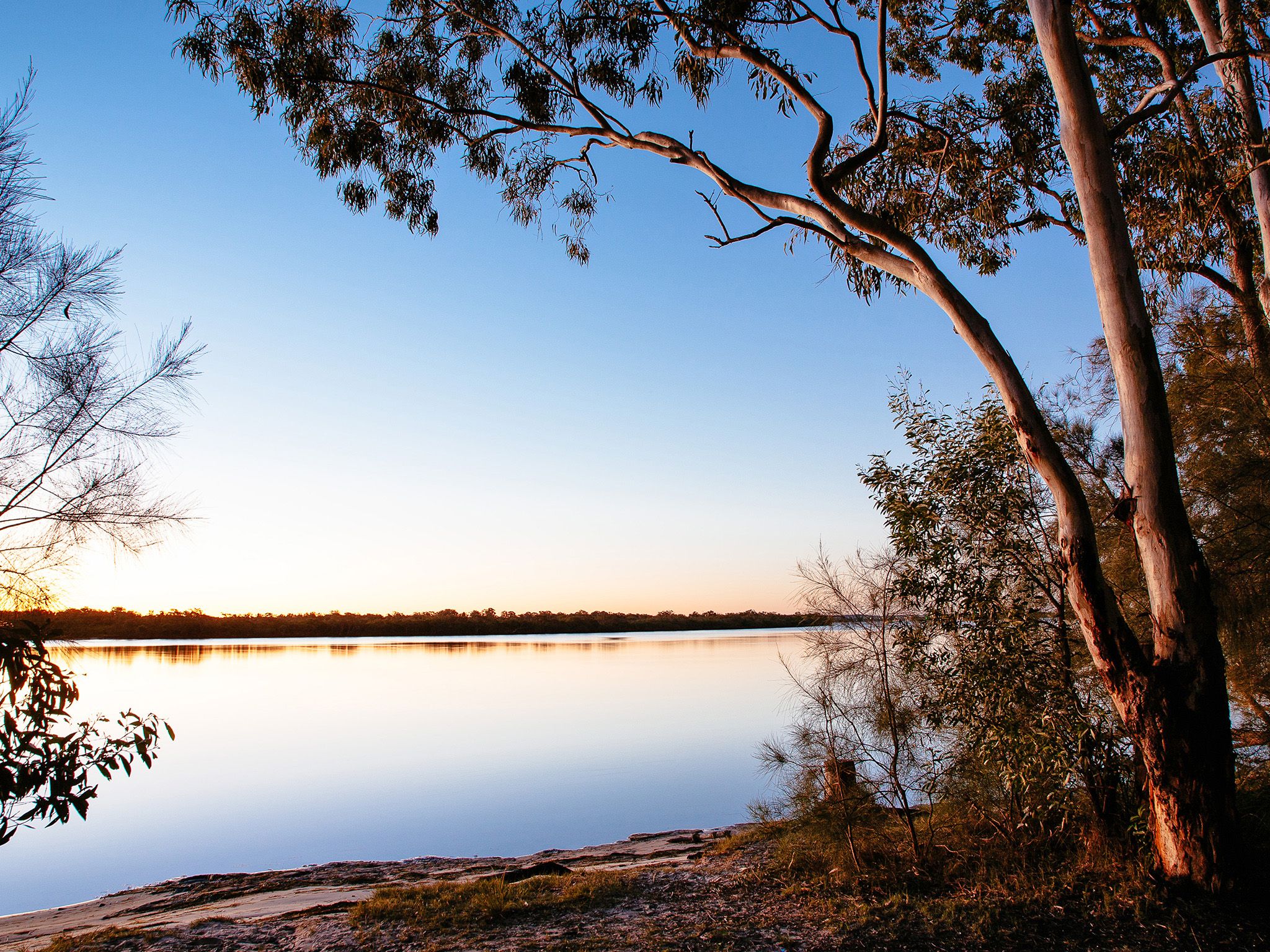
![Enjoy gorgeous coastal views of Pumicestone Passage.]() Enjoy gorgeous coastal views of Pumicestone Passage.
Photo credit: © Ben Blanche
Enjoy gorgeous coastal views of Pumicestone Passage.
Photo credit: © Ben Blanche
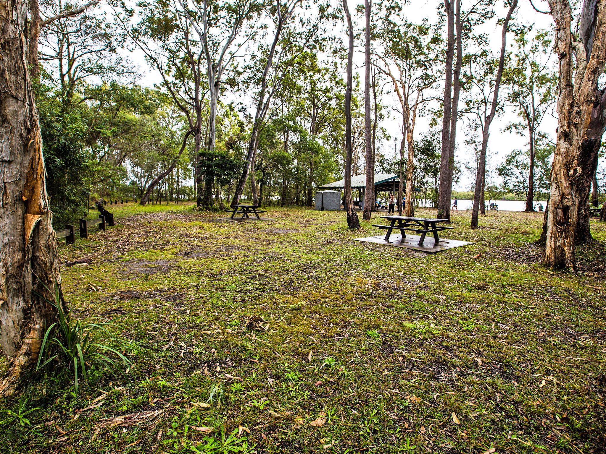
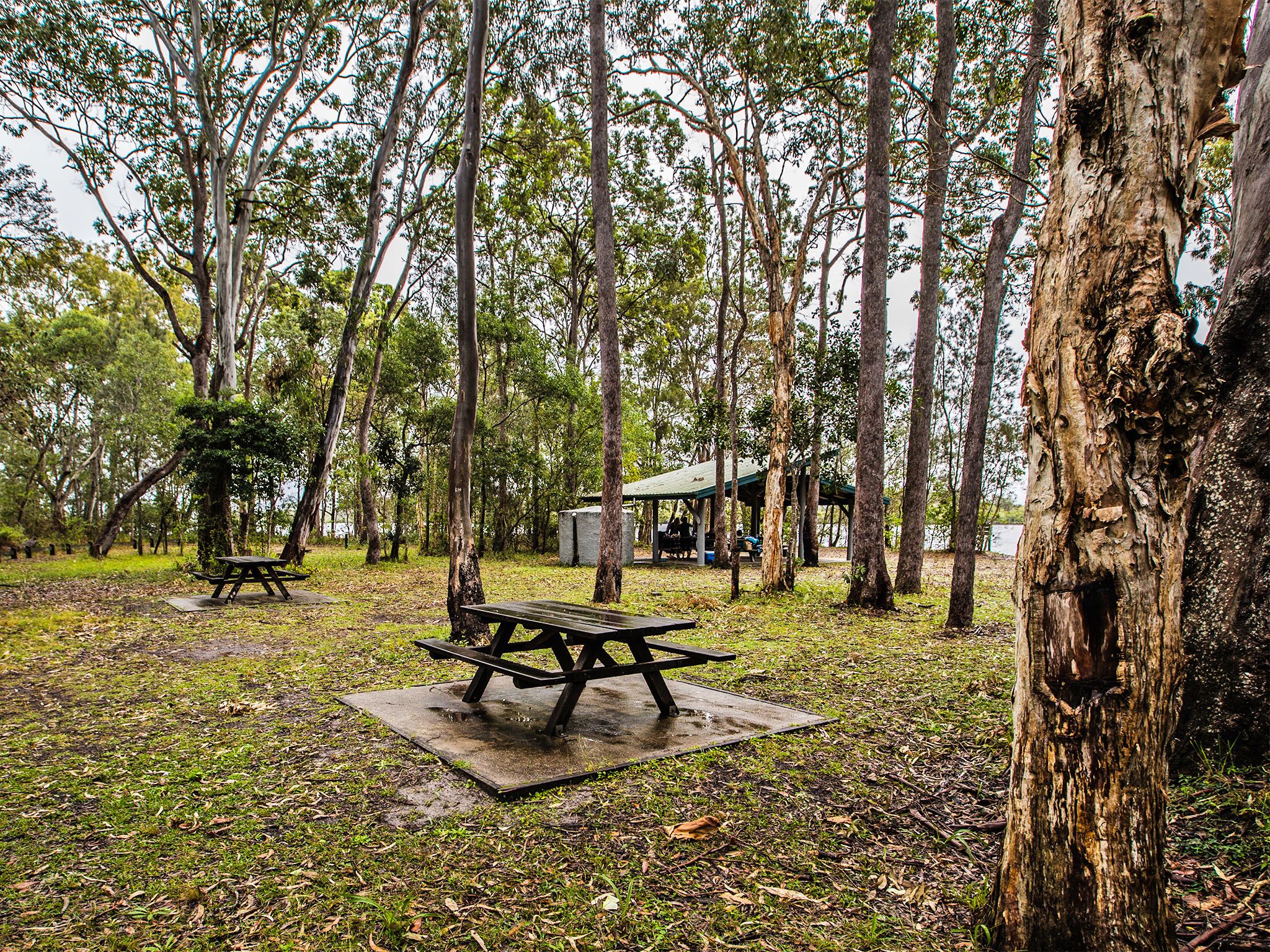


Spend the afternoon relaxing over a BBQ in this open grassy day-use area. Nestled in among casuarinas and eucalypts you'll find plenty of shade for the picnic table.
Walk along the roadside, or at low tide walk along the shore, to the lighthouse site. Imagine the lighthouse strucutre that once stood beyond the sand hill, beaming its warning for 56 years until 1952. Look for the concrete base—all that remains of the second lighthouse that replaced the first.
Wander along the water's edge, launch your kayak from the shore, try your luck at fishing, or continue your 4WD along the Northern access track to Fort Bribie day-use area to explore the World War II remnants.
Getting there and getting around
Lighthouse Reach day-use area is in Bribie Island National Park and Recreation Area, 65km north of Brisbane.
- This day-use area is at the northern end of the island and can be accessed via two routes requiring high-clearance 4WD with low range capability; or by boat.
- A vehicle access permit must be purchased. Display the permit on your windscreen before driving in the recreation area. 24hr number plate surveillance cameras in use. Please ensure vehicle registration details are correct on your permit. For more information see:
- Two-wheel-drive (2WD) vehicles, trail bikes and motorbikes are prohibited from obtaining a vehicle access permit and entering the Bribie Island Recreation Area.
- Read 4WD with care for important information on 4WD safety and minimal impact driving.
Northern access track
- From the bridge, drive north along Sunderland Drive and continue along White Patch Esplanade.
- At White Patch, follow the main track north to the gate at the turn-off to the Poverty Creek camping area. This is the start of the Northern access track.
- Drive 14.5km along this inland track to the northern part of the island and Lighthouse Reach.
Ocean beach drive
- From the bridge, follow the signposts to Woorim township on the east side of the island.
- The Ocean Beach drive starts at the end of North Street and continues north along the beach for 25km to Lighthouse Reach.
Speed limits
- 30km/hr from Ocean Beach drive to 300m north of Norfolk Creek (second lagoon).
- 30km/hr near Ocean beach camping area and on inland tracks.
- 50km/hr on the beach unless otherwise specified.
Boat access
- The closest boat ramps are on the mainland at Golden Beach, Bells Creek and Coochin Creek.
- Boat ramps are also located at Sandstone Point, Toorbul and Donnybrook on the mainland.
- On the island you can launch your boat at Bellara and Bongaree boat ramps.
- When boating over seagrass beds in Pumicestone Passage, do your best to minimise impacts on dugongs. Take it easy and observe the go slow areas .
- Read boat and fish with care for tips on boating and fishing safety and caring for parks.
Getting to Bribie Island
The island can be reached via a road bridge from the Caboolture turn-off on the Bruce Highway, or by boat from the nearby mainland.
Wheelchair access
There are no wheelchair-accessible facilities.
Before you visit
Opening hours
Lighthouse Reach day-use area is open 24 hours a day
Check park alerts for the latest information on access, closures and conditions.
Visiting safely
For more safety information see Visiting Bribie safely.
- Poverty Creek camping area closed from 15 April 2024 for toilet block upgrade 3 November 2023 to 8 July 2024
- Smoke hazard from forestry planned burn 19–22 April 2024
- Drive with care during marine turtle nesting season 6 March to 3 June 2024
- Camp site booking restrictions due to tidal inundation 11 January to 31 December 2024
- Bribie Island’s northern breakaway section remains part of the recreation area 30 June 2023 to 30 December 2024