Cooloola Sandpatch walk
Discover one of Cooloola’s iconic natural wonders, a large sandblow on towering sandmass hills with panoramic views over the upper Noosa River.
- Journey type
- Walk
- Distance
- 12km return Start and finish points are the same and the traveller must return via the same path
- Time suggested
- Allow 5hrs walking time.
- Grade
- Grade 4 walking track
Accessible by
- High clearance 4WD
- Boat
Journey facilities
- Lookout (natural)
- Walking
-
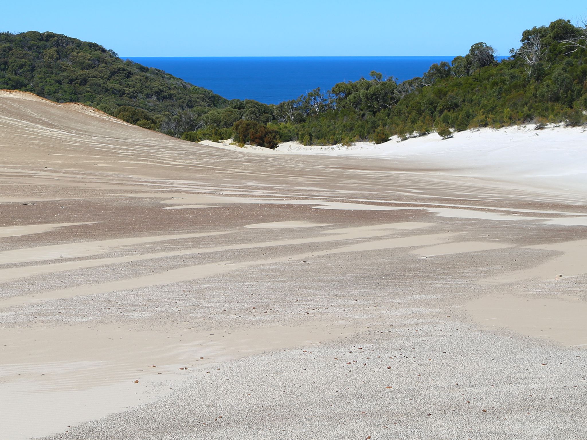
![Take a walk across the Cooloola Sandpatch and be rewarded with panoramic views.]() Take a walk across the Cooloola Sandpatch and be rewarded with panoramic views.
Photo credit: © Sue Gregory
Take a walk across the Cooloola Sandpatch and be rewarded with panoramic views.
Photo credit: © Sue Gregory
-
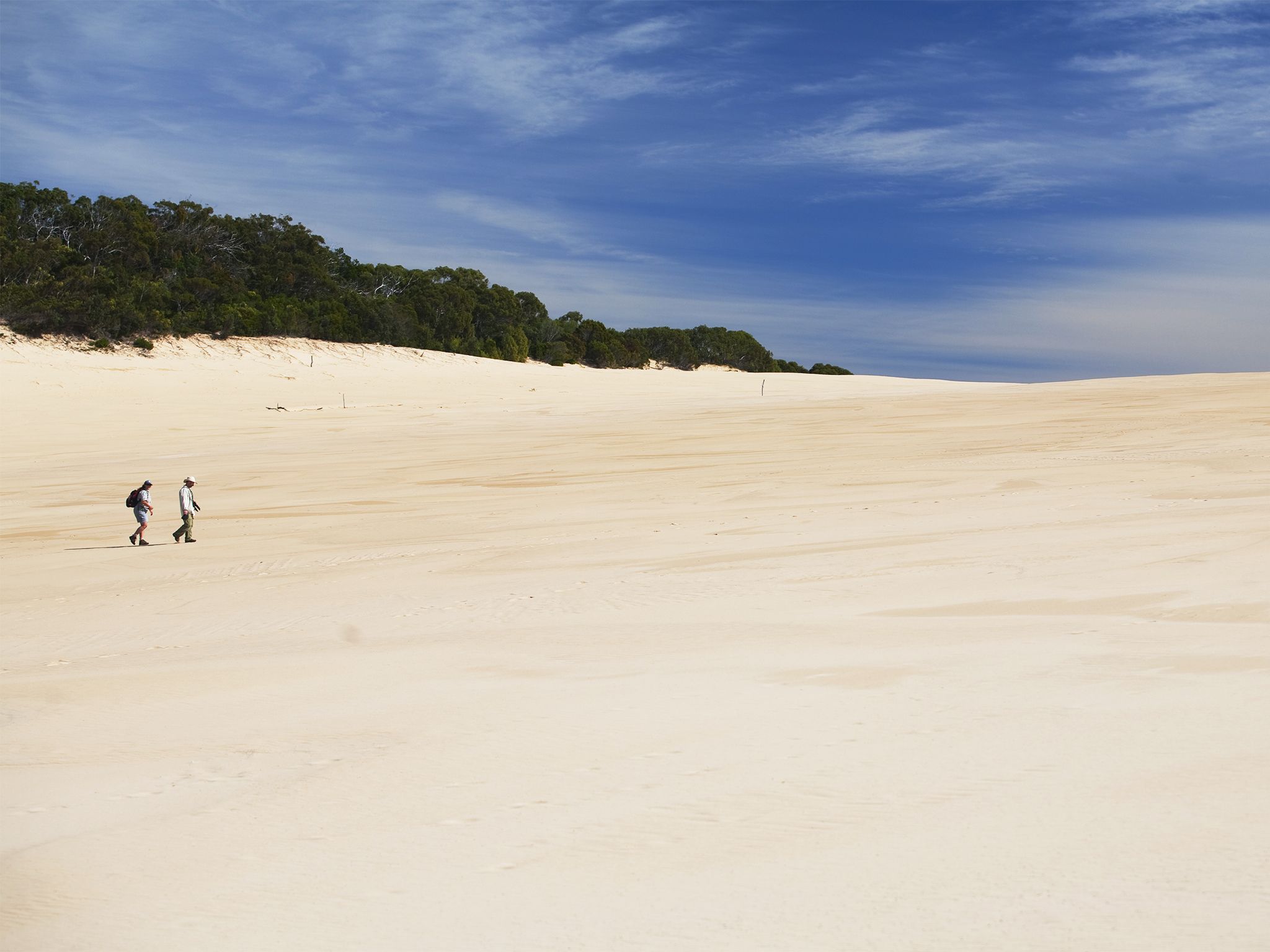
![Discover a 2km long sandblow known as the Cooloola Sandpatch on this walk.]() Discover a 2km long sandblow known as the Cooloola Sandpatch on this walk.
Photo credit: Robert Ashdown © Queensland Government
Discover a 2km long sandblow known as the Cooloola Sandpatch on this walk.
Photo credit: Robert Ashdown © Queensland Government
Revel in this adventurous hike from camp site 3 on the upper Noosa River to the northern end of a sandblow known as the Cooloola Sandpatch. This walk follows the Cooloola Great Walk, meandering through coastal heath along a low sandy ridge then clambering up the steep but shaded sides of the Cooloola Sandmass. As you climb, your path will take you through blackbutt and scribbly gum forests and woodlands with an understorey of grass-trees.
Feel the exhilaration of making it to edge of the Cooloola Sandpatch, 2km long and bare of vegetation. Enjoy panoramic views back over the upper Noosa River catchment, including Lake Cooloola, Lake Como and Lake Cootharaba.
Refer to the Cooloola and Inskip recreation areas discovery guide for a map and more details.
Getting there and getting around
Cooloola Sandpatch walk is in Cooloola Recreation Area, Great Sandy National Park, on the Sunshine Coast between Noosa Heads and Rainbow Beach (155km–240km north of Brisbane).
- This walk is in the southern part of Cooloola in the Upper Noosa River waterway and starts at camp site 3.
- You can access this walk via canoe from Elanda Point or boat from Boreen Point boat ramp.
- Alternatively you can paddle a canoe or walk from Harry's day-use area, which is accessible only by high clearance 4WD.
- Read boat and fish with care for tips on boating and fishing safety and caring for parks.
- Read water safety for important information about staying safe in and near water and caring for parks.
From Elanda Point and Boreen Point
- From Brisbane drive 135km north on the Bruce Highway or the Sunshine Motorway to Tewantin; or from Gympie drive 58km south and east on the Bruce Highway to Tewantin.
- From Tewantin drive 19km west and north via McKinnon Drive and Louis Bazzo Drive to Boreen Point. Turn left onto Lake Flat Road and drive 2km to the Elanda Point access road.
By canoe
- Launch your canoe at Elanda Point and paddle 19.2km (3hrs 40mins) across Lake Cootharaba and into the Upper Noosa River to camp site 3
- Stay close to the shore line while paddling northwards across the lake. Plan to cross Lake Cootharaba early in the morning when conditions are likely to be calm and easy to travel.
By boat
- Launch your boat from the Boreen Point boat ramp and travel 21.7km (1hr 45mins) to camp site 3
- From the boat ramp, follow the lake navigation markers out into deeper water of Lake Cootharaba and then head on a north-east trajectory towards the visible Cooloola Sandpatch in the distant landscape.
- When you approach a red navigational marker in the middle of the lake (opposite Elanda Point), turn on a near northerly trajectory to the channel markers through very shallow shoals to the Kinaba Visitor Information Centre.
- From Kinaba, travel north (6 knots maximum speed limit) to Fig Tree Point day-use area and then follow Upper Noosa River to camp site 3.
Via Harry's day-use area
- From Brisbane, drive 135km north on the Bruce Highway or the Sunshine Motorway to Tewantin. Follow McKinnon Drive, Louis Bazzo Drive and Junction Road for about 18km north-west to Cootharaba Road. Turn right and travel about 10km along Cootharaba, Kimmond Creek and Dr Pages roads to the Gympie Kin Kin Road. Turn right and drive 6km, then turn right onto Cooloola Way.
- From Gympie, drive 10km east on Tin Can Bay Road, turn right onto to the Gympie Kin Kin Road and drive about 31km, then turn left onto Cooloola Way.
- Drive 4km on Cooloola Way then turn right into Harry's Hut road and drive another 10km on this very rough sand track to Harry's day-use area.
- Launch your canoe to cross the river to the start of the camp site 3 walk and walk 7km (3hrs) to camp site 3 to the start of the Cooloola Sandpatch walk.
- Alternatively, paddle your canoe from Harry's day-use area for 7.7km (1hr 20mins) to camp site 3 and the start of this walk.
- Read 4WD with care for important information on 4WD safety and minimal impact driving.
Wheelchair access
There are no wheelchair-accessible facilities.
Before you visit
Opening hours
Cooloola Sandpatch walk is open 24 hours a day.
Check park alerts for the latest information on access, closures and conditions.
Visiting safely
For more safety information see Visiting Cooloola Recreation Area safely and Walk with care.
- Pest control program at Teewah Beach and Freshwater camping areas 13–16 May 2024
- King’s Bore Circuit temporary closure 12 May to 10 June 2024
- Planned Burn - Block 8 24–28 April 2024
- Annual Cooloola Hazard Reduction Burn Program 15 April to 31 August 2024
- Permanent fire prohibition on Teewah Beach 1 April 2021 to 11 October 2024
- Cooloola Wilderness Trail - No pedestrian access across Kin Kin Creek 31 January to 1 July 2024
- Portable toilets mandatory for Teewah Beach camping zones 15 March 2022 to 29 November 2024
- Unstable sand cliffs and dunes along Rainbow and Teewah beaches 4 August 2023 to 30 June 2024
- Marine turtles breeding season 1 November 2023 to 30 April 2024
Conditions report
Cooloola conditions report Updated 17 Apr 2024
Critical information for your safety is included in the conditions report—always check it before you visit.