Peak trail
Soak up spectacular views of Mount Norman as you walk or mountain bike ride through Girraween's remote forests.
- Journey type
- Walk, cycle
- Distance
- 10.6km return Start and finish points are the same and the traveller must return via the same path
- Time suggested
- Allow 2hr walking time or 1hr riding time (variable depending on rider).
- Grade
- Grade 3 walking track Intermediate mountain-bike trail
Accessible by
- Conventional vehicle
- Bicycle
Journey facilities
- Walking
- Cycling
-
![The Peak trail passes through Girraween's remote forests.]() The Peak trail passes through Girraween's remote forests.
Photo credit: © Ben Blanche
The Peak trail passes through Girraween's remote forests.
Photo credit: © Ben Blanche
-
![The Peak trail offers spectacular views of Mount Norman.]() The Peak trail offers spectacular views of Mount Norman.
Photo credit: © Ben Blanche
The Peak trail offers spectacular views of Mount Norman.
Photo credit: © Ben Blanche
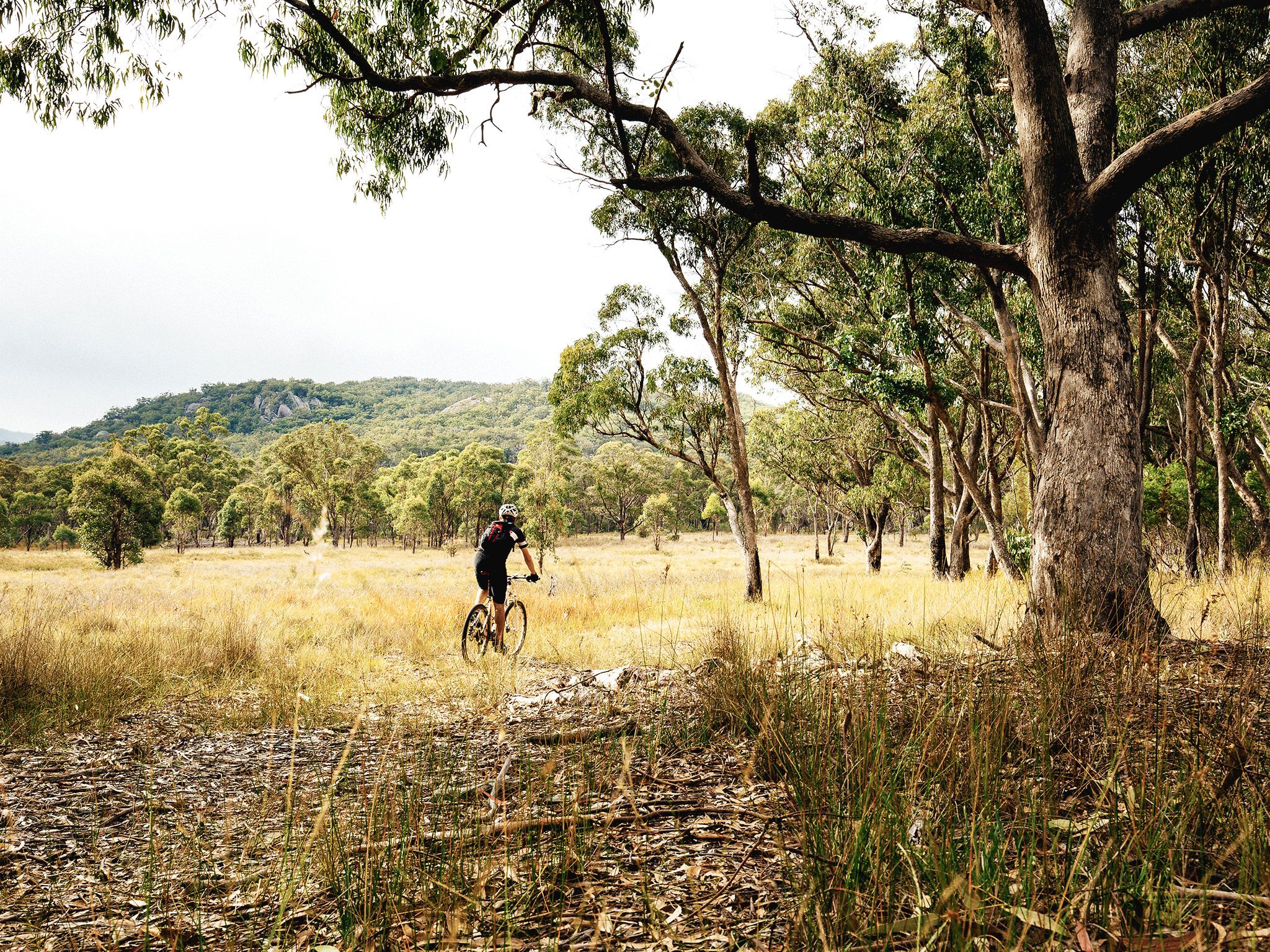

Spend the day venturing through the park's more remote areas on foot or on two wheels. Discover unspoilt forests of New England blackbutt and Wallangarra white gums on this shared trail that is mostly easy but with some intermediate sections. Be rewarded by great views of Mount Norman, and, in spring, feast your eyes on spectacular displays of wildflowers. Listen for superb lyrebirds, Girraween's resident mimics, calling in winter.
For mountain bikers who want a longer ride, combine the Peak trail with the Creek trail.
Getting there and getting around
The Peak trail is one of the southern trails in Girraween National Park, located on the Queensland–New South Wales border, 260km by road south-west of Brisbane.
The Peak trail starts from the Mount Norman day-use area.
There are two access roads (northern and southern) to the day-use area. The southern is accessible by conventional vehicles while sections of the route along Mount Norman Road from the northern park entrance are 4WD access only.
From Brisbane to northern entrance
- Drive about 220km south-west along the New England Highway via Warwick to Stanthorpe.
- Turn onto Sugarloaf Road, which turns into Eukey Road and drive about 15km via Storm King Dam towards Eukey.
- About 1km before Eukey, turn onto Breens Road, drive 2.5km then turn onto Pyramids Road and drive about 6km to the northern park entrance.
- Turn left and drive 11km along Mount Norman Road to the Mount Norman day-use area. Sections of this road are 4WD only.
- Read 4WD with care for important information on 4WD safety and minimal impact driving.
From Tenterfield to southern entrance
- Drive 18km north on the New England Highway to Wallangarra.
- In Wallangarra, cross to the eastern side of the railway line, go over the railway bridge and turn left onto sealed and signposted Mount Norman Road.
- After about 2km the road changes to gravel, turn right across a grid and continue for 1km then turn right at the water treatment plant and enter the park.
- Drive 3.5km along Mount Norman Road to the Mount Norman day-use area.
Wheelchair access
There are no wheelchair-accessible facilities.
Before you visit
Opening hours
Peak trail is open 24 hours a day.
Check park alerts for the latest information on access, closures and conditions.
Visiting safely
For more safety information see:
- Planned burn - Girraween National Park 18–22 April 2024