Chilli Beach day-use area
Let the tangy salt air and stiff sea breezes wash away the dust of your journey as you relax over a shady beachside picnic.
Accessible by
- High clearance 4WD
Attraction facilities
- Toilets (non-flush)
- Picnic tables
-
![Chilli Beach day-use area is a shady picnic area on the edge of the beach, fringed by rainforest.]() Chilli Beach day-use area is a shady picnic area on the edge of the beach, fringed by rainforest.
Photo credit: © Queensland Government
Chilli Beach day-use area is a shady picnic area on the edge of the beach, fringed by rainforest.
Photo credit: © Queensland Government
-
![Throw in a fishing line or look for seabirds along Chilli Beach.]() Throw in a fishing line or look for seabirds along Chilli Beach.
Photo credit: © Queensland Government
Throw in a fishing line or look for seabirds along Chilli Beach.
Photo credit: © Queensland Government
-
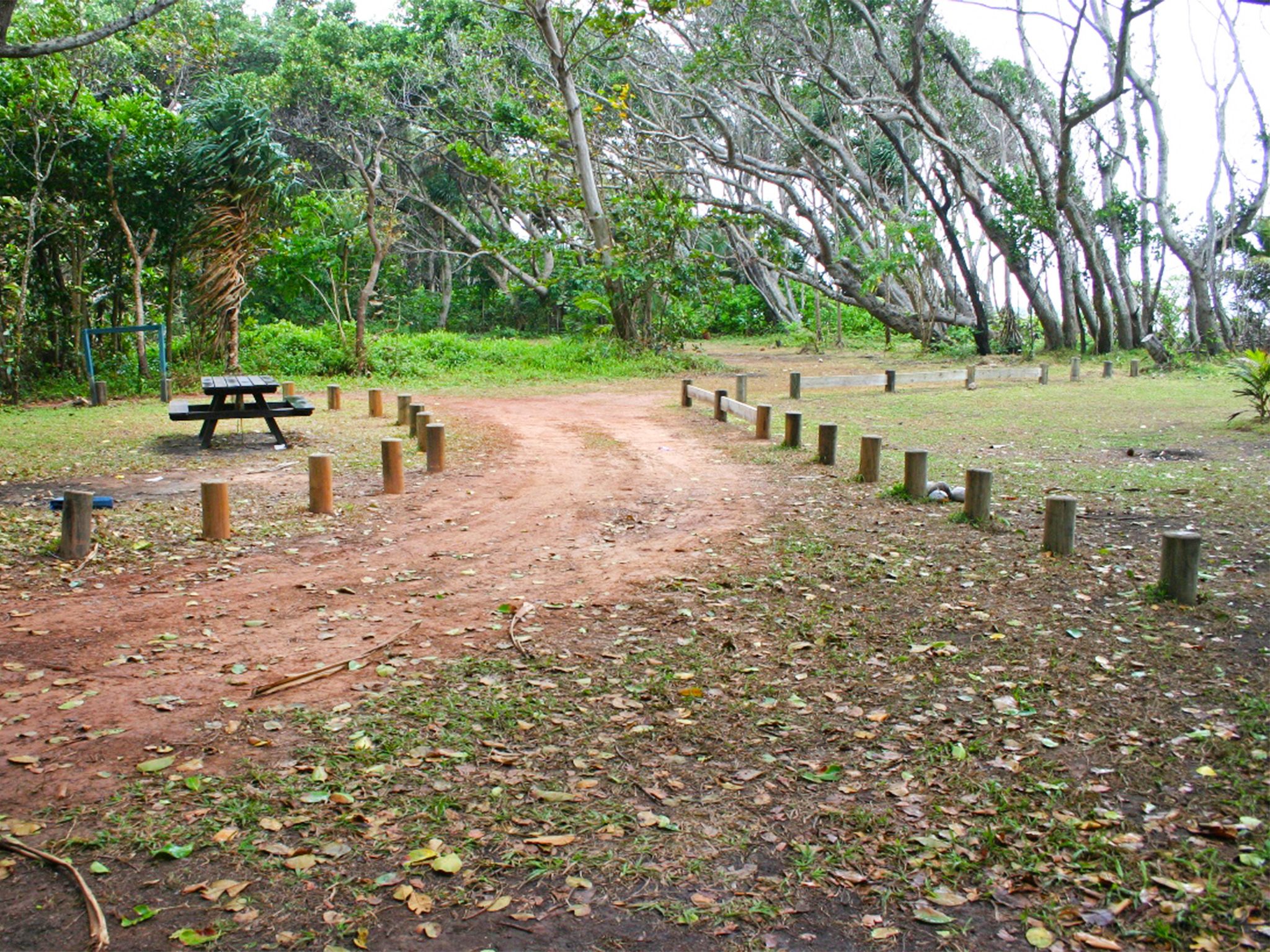
![There is a toilet near the picnic tables at Chilli Beach day-use area.]() There is a toilet near the picnic tables at Chilli Beach day-use area.
Photo credit: Ian Holloway © Queensland Government
There is a toilet near the picnic tables at Chilli Beach day-use area.
Photo credit: Ian Holloway © Queensland Government
-
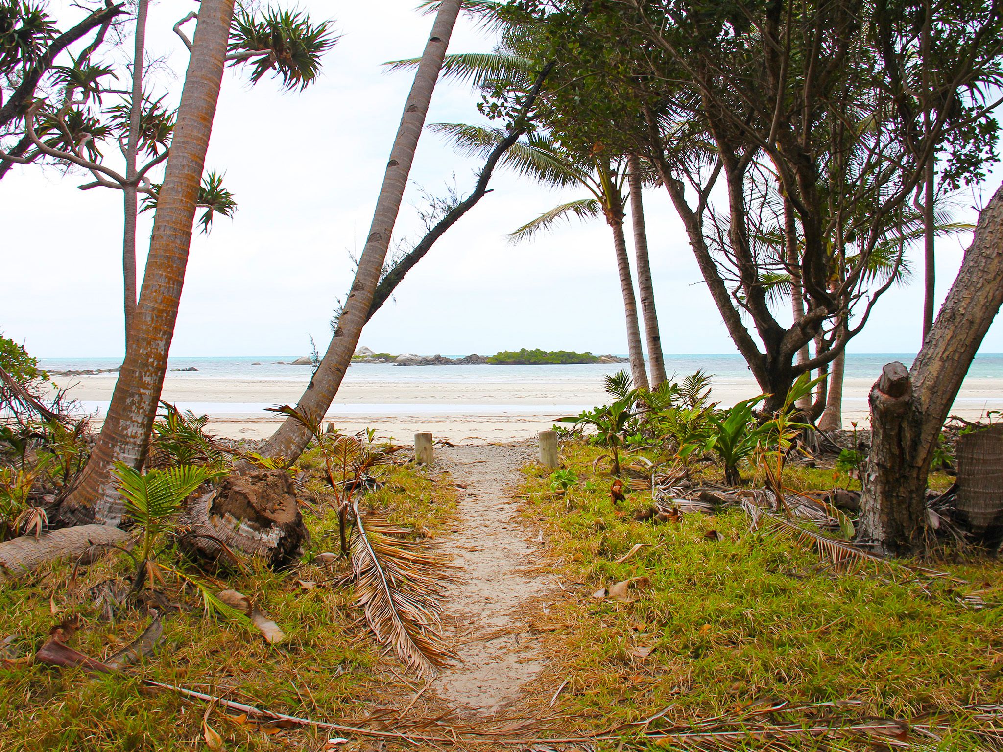
![It's a very short walk from the picnic table to the beach at Chilli Beach day-use area.]() It's a very short walk from the picnic table to the beach at Chilli Beach day-use area.
Photo credit: Ian Holloway © Queensland Government
It's a very short walk from the picnic table to the beach at Chilli Beach day-use area.
Photo credit: Ian Holloway © Queensland Government
-
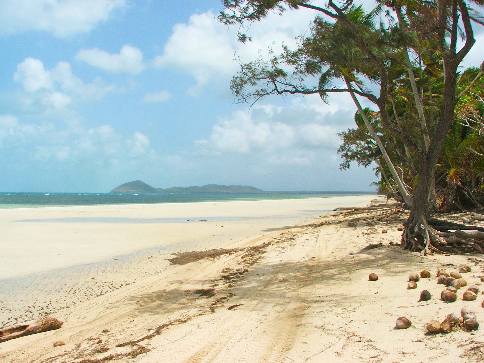
![Enjoy a walk along Chilli Beach from Chilli Beach day-use area.]() Enjoy a walk along Chilli Beach from Chilli Beach day-use area.
Photo credit: Adam Creed © Queensland Government
Enjoy a walk along Chilli Beach from Chilli Beach day-use area.
Photo credit: Adam Creed © Queensland Government
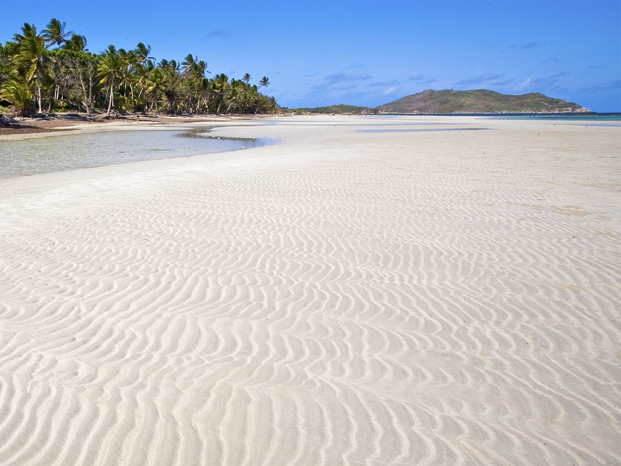
At the northern end of the Chilli Beach camping area, lounge over a restful picnic in the shade, enjoying the cooling sea breeze and panoramic ocean views. Explore the dunes on the Chilli Beach forest walk or step out onto the famous white quartz sands of Chilli Beach’s sweeping coastline, which stretches between Cape Griffith and Cape Weymouth.
Watch seabirds soaring gracefully overhead. Stroll to the northern end of the beach and fossick among debris washed up by ocean currents from as far away as Vanuatu and the Philippines. Cast a fishing line from the shore or take the boat out for a day’s fishing.
Kutini-Payamu (Iron Range) National Park (CYPAL) is jointly managed by the Northern Kuuku Ya'u Kanthanampu Aboriginal Corporation RNTBC Land Trust and the Queensland Government.
Getting there and getting around
The Chilli Beach day-use area is in Kutini-Payamu (Iron Range) National Park (CYPAL), about 200km north of Coen on Cape York Peninsula.
- From the park entrance, drive 36.9km along Portland Roads Road to the Chilli Beach turn-off, then drive a further 6km to the day-use area.
- You can access the park from the south via the Peninsula Developmental Road or from the north via the challenging and unpredictable Frenchmans Track.
- For both routes, you need a high clearance 4WD with recovery gear and extra supplies; and you need to be proficient in four-wheel driving.
- On Frenchmans Track your vehicle also needs a snorkel; and you should be experienced in challenging 4WD conditions.
- If you're towing a trailer, take the Peninsula Developmental Road route; neither route is suitable for towing caravans.
- To book camping at the self-service booking facility at the ranger base, drive 14km along Portland Roads Road and turn right into Lockhart River Road. The ranger base is 2.5km along this road.
- Alcohol restrictions are in place in many of Queensland's Aboriginal and Torres Strait Islander communities and apply to the towns and areas around Kutini-Payamu (Iron Range) National Park (CYPAL). For the latest information on restrictions, see Community alcohol limits. The camping areas in the park are outside the alcohol restriction zone.
- Read 4WD with care for important information on 4WD safety and minimal impact driving.
Peninsula Developmental Road
Turn off the Peninsula Developmental Road onto Portland Roads Road, 35km north of the Archer River Roadhouse (175km south-west of Weipa), and drive 83km along this well-formed gravel road to the park entrance.
Frenchmans Track
Turn off the Telegraph Road onto Frenchmans Track, 22km south of Moreton Telegraph Station, and drive 52km to the intersection with Portland Roads Road, then turn left onto Portland Roads Road and travel a further 13km to the park entrance.
Wheelchair access
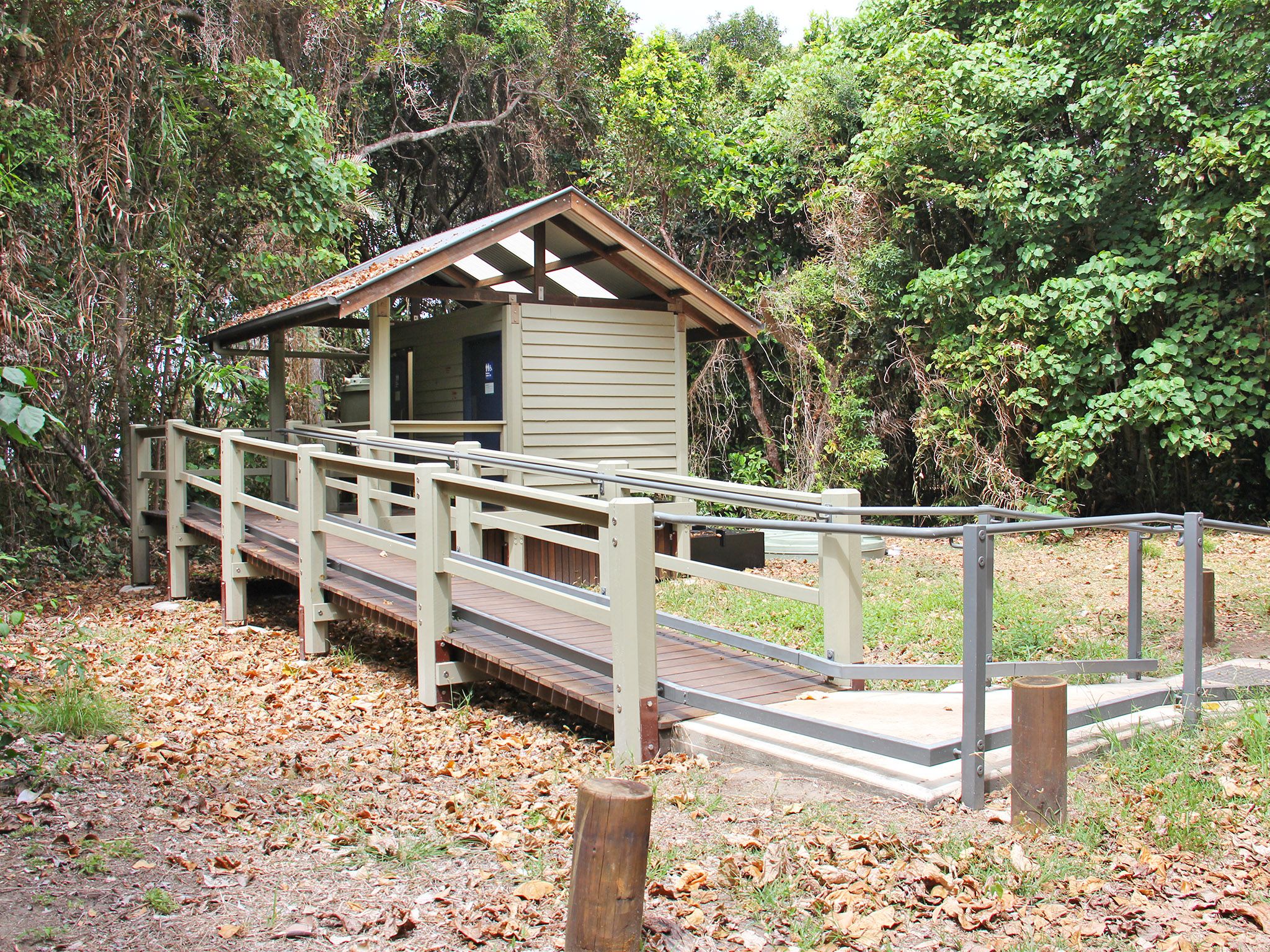
There are no wheelchair-accessible facilities.
Drinking water
- Collect bore water from the roadside tank about 1km from Chilli Beach or from the tap at the Iron Range ranger base.
- Treat all water before use.
Before you visit
Opening hours
Chilli Beach day-use area is open 24 hours a day
Check park alerts for the latest information on access, closures and conditions.
Seasonal closures
The park may be closed during the wetter summer months.
Visiting safely
For more safety information see Visiting Kutini-Payamu (Iron Range) safely.
- There are currently no park alerts for this park.