Cooks Hut camping area
Set up camp in the shade of cool rainforest, with a musical backdrop of birdsong, and discover the story of historic Cooks Hut.
Accessible by
- 4WD
Camping area facilities
- Campfires allowed (conditions apply)
- Toilets (non-flush)
- Tent camping
- Camper trailer camping
- Tent camping beside car
- Scenic drive
-
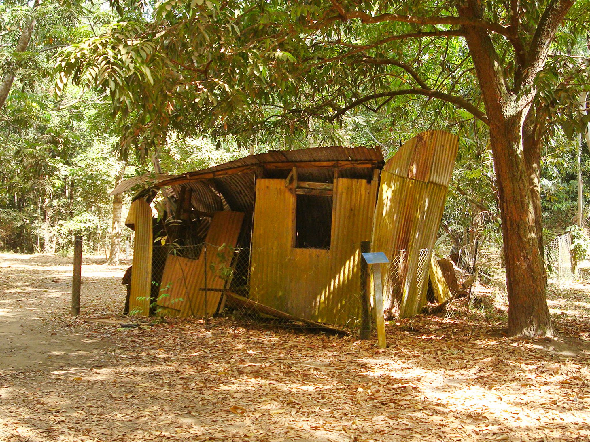
![This camping area is named for Cooks Hut, built after WWII by gold prospector, Reginald Cook.]() This camping area is named for Cooks Hut, built after WWII by gold prospector, Reginald Cook.
Photo credit: © Queensland Government
This camping area is named for Cooks Hut, built after WWII by gold prospector, Reginald Cook.
Photo credit: © Queensland Government
-
![You'll find microflush toilets at Cooks Hut camping area.]() You'll find microflush toilets at Cooks Hut camping area.
Photo credit: Ian Holloway © Queensland Government
You'll find microflush toilets at Cooks Hut camping area.
Photo credit: Ian Holloway © Queensland Government
-
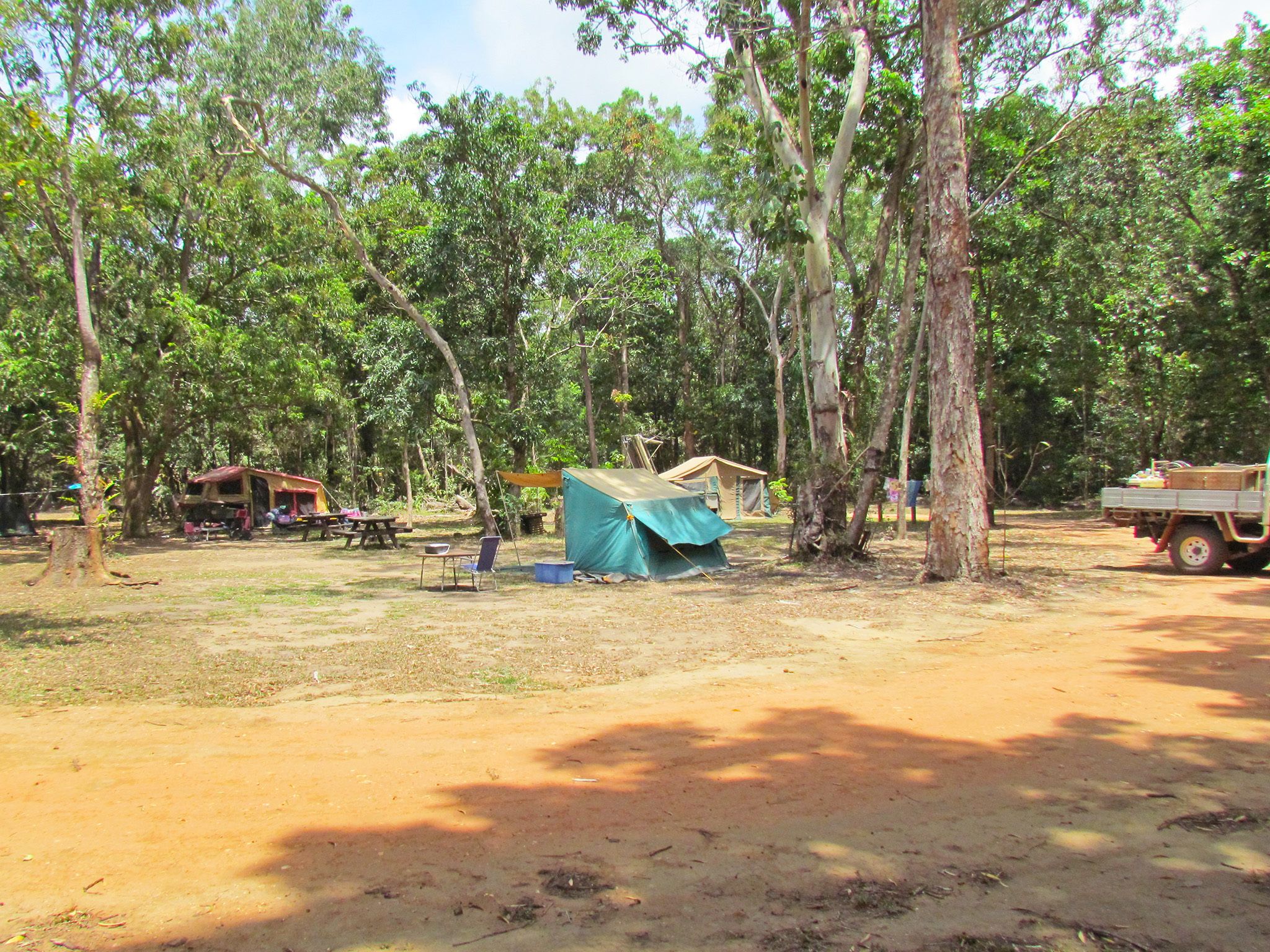
![Enjoy shady camp sites in the rainforest at Cooks Hut camping area.]() Enjoy shady camp sites in the rainforest at Cooks Hut camping area.
Photo credit: Ian Holloway © Queensland Government
Enjoy shady camp sites in the rainforest at Cooks Hut camping area.
Photo credit: Ian Holloway © Queensland Government
-
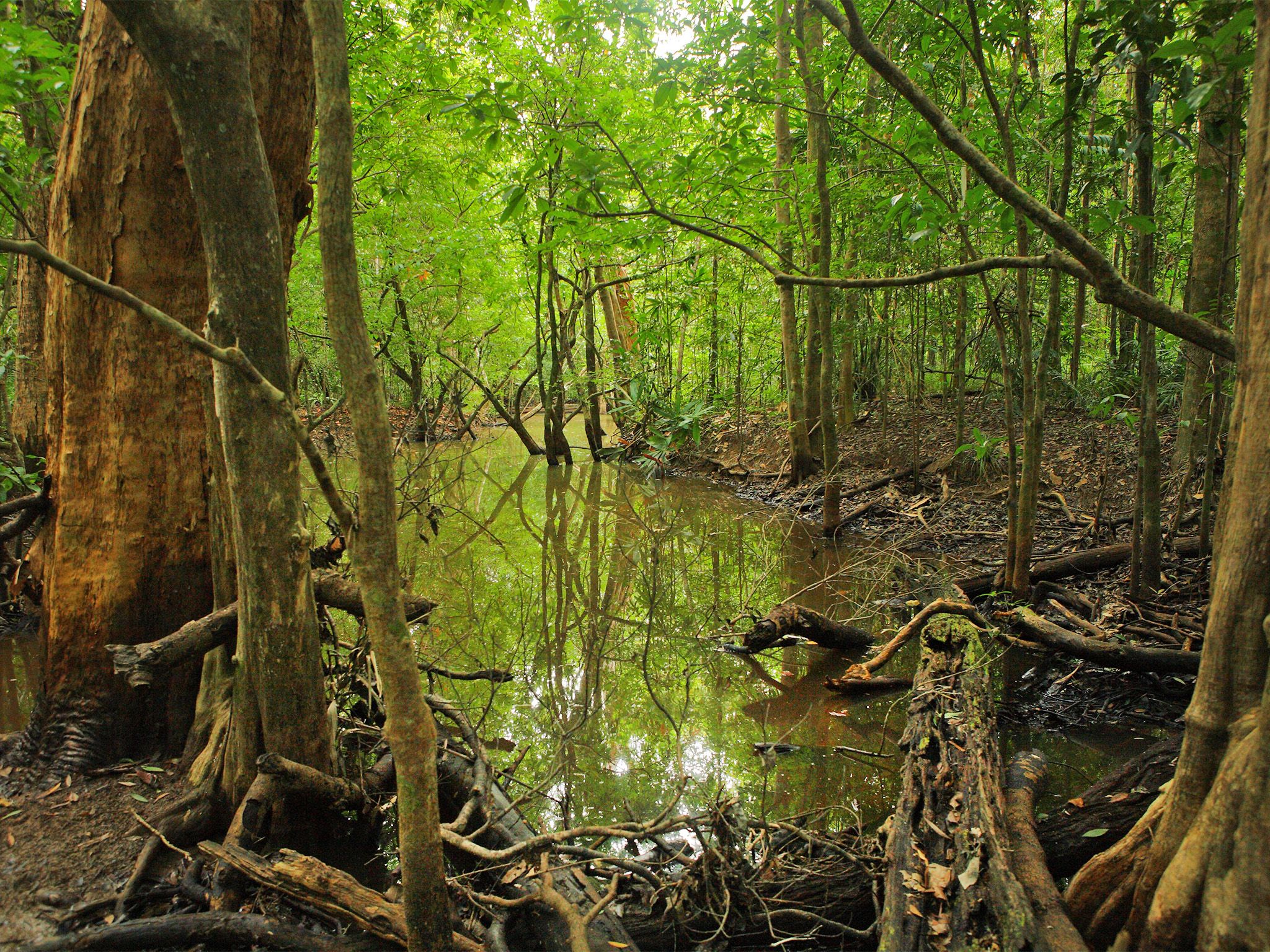
![Camp in lush rainforest near the Claudie River at Cooks Hut camping area.]() Camp in lush rainforest near the Claudie River at Cooks Hut camping area.
Photo credit: © John Augusteyn
Camp in lush rainforest near the Claudie River at Cooks Hut camping area.
Photo credit: © John Augusteyn
-
![Cooks Hut camping area is popular during peak periods, so book well in advance.]() Cooks Hut camping area is popular during peak periods, so book well in advance.
Photo credit: Gary Featonby © Queensland Government
Cooks Hut camping area is popular during peak periods, so book well in advance.
Photo credit: Gary Featonby © Queensland Government
-
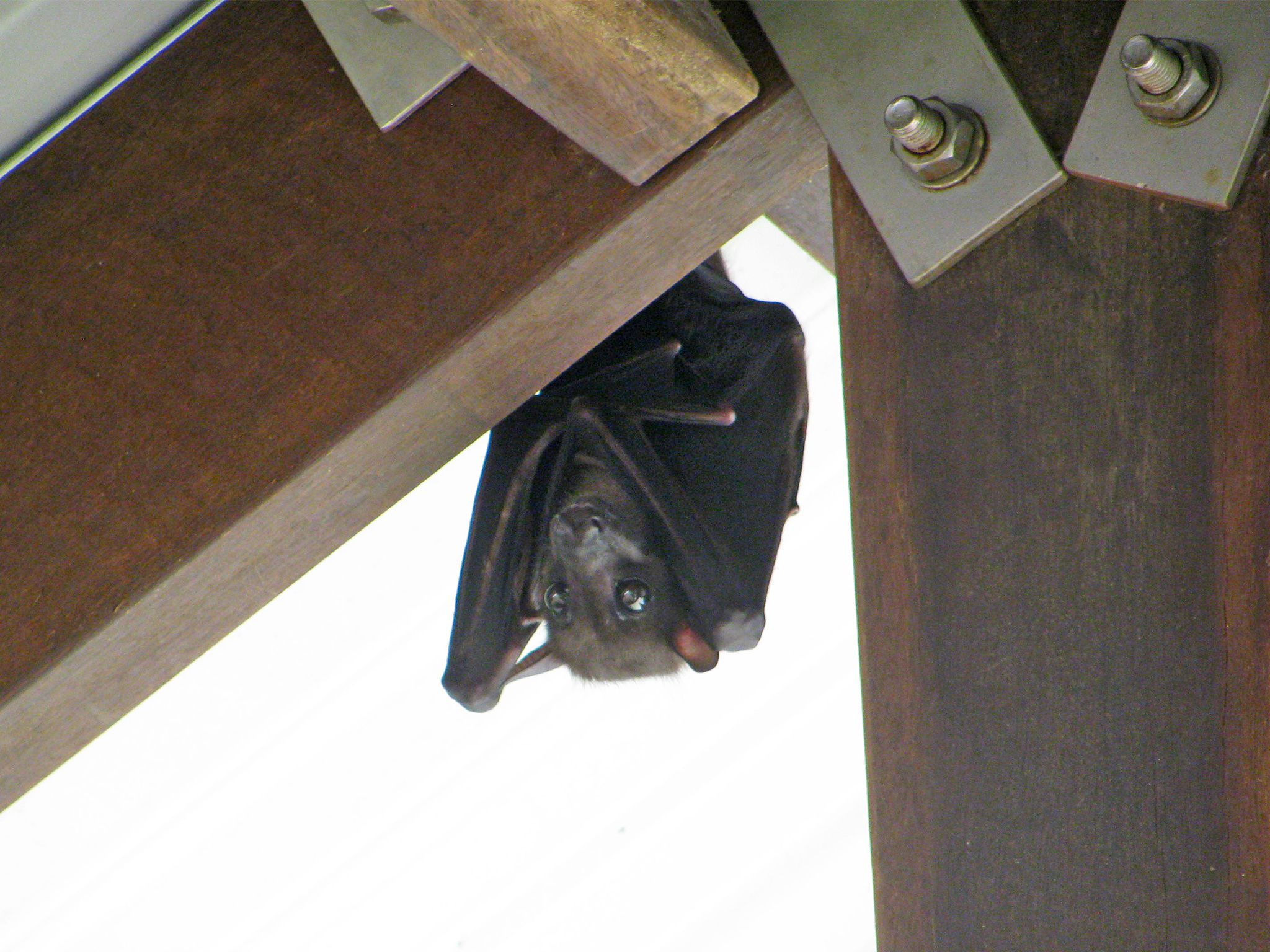
![At night, you may hear the distinctive flapping of bare-backed fruit bats as they fly over the camping area.]() At night, you may hear the distinctive flapping of bare-backed fruit bats as they fly over the camping area.
Photo credit: Russel Edwards © Queensland Government
At night, you may hear the distinctive flapping of bare-backed fruit bats as they fly over the camping area.
Photo credit: Russel Edwards © Queensland Government


Always check
- Park alerts for the latest information on access, closures and conditions.
- Bureau of Meteorology weather forecasts.
- Current bushfire warnings and incidents and also fire bans and restrictions.
- Your camping permit is booked.
- Any park-specific camping information for
Kutini-Payamu (Iron Range).
- Visiting Kutini-Payamu (Iron Range) safely for important safety information.
The self-service kiosk at this park has been decommissioned.
Visitors need to book their camping permit before they visit. Book online, at an over-the-counter booking office or by phone.
Relish the cool respite offered by this camping area in lowland rainforest near the Claudie River. Enjoy birdwatching by day and wildlife spotlighting at night then relax around the camp fire.
Glimpse the area’s past at Cooks Hut. During World War II, the area was used as an army base for troops and heavy bombers. Local miners left the area, and only a few drifted back after the war. Gold prospector Reginald Cook returned and built this hut from material scavenged from mine sites. He lived here until the early 1970s, mining small mineral deposits and working as a ganger on the roads—armed with a wheelbarrow and shovels, he filled potholes and maintained bridges.
Kutini-Payamu (Iron Range) National Park (CYPAL) is jointly managed by the Northern Kuuku Ya'u Kanthanampu Aboriginal Corporation RNTBC Land Trust and the Queensland Government.
Getting there and getting around
Cooks Hut camping area is in Kutini-Payamu (Iron Range) National Park (CYPAL), 200km north of Coen on Cape York Peninsula.
- From the park entrance, drive 18.8km along Portland Roads Road to this camping area.
- You can access the park from the south via the Peninsula Developmental Road or from the north via the challenging and unpredictable Frenchmans Track.
- For both routes, you need a high clearance 4WD with recovery gear and extra supplies; and you need to be proficient in four-wheel driving.
- On Frenchmans Track your vehicle also needs a snorkel; and you should be experienced in challenging 4WD conditions.
- If you're towing a trailer, take the Peninsula Developmental Road route; neither route is suitable for towing caravans.
- Alcohol restrictions are in place in many of Queensland's Aboriginal and Torres Strait Islander communities and apply to the towns and areas around Kutini-Payamu (Iron Range) National Park (CYPAL). For the latest information on restrictions, see Community alcohol limits. The camping areas in the park are outside the alcohol restriction zone.
- Read 4WD with care for important information on 4WD safety and minimal impact driving.
Peninsula Developmental Road
Turn off the Peninsula Developmental Road onto Portland Roads Road, 35km north of the Archer River Roadhouse (175km south-west of Weipa), and drive 83km along this well-formed gravel road to the park entrance.
Frenchmans Track
Turn off the Telegraph Road onto Frenchmans Track, 22km south of Moreton Telegraph Station, and drive 52km to the intersection with Portland Roads Road, then turn left onto Portland Roads Road and travel a further 13km to the park entrance.
Before you visit
Opening hours
Cooks Hut camping area is open 24 hours a day. Check-in to your camp after 2pm and check-out by 11am on the day of departure.
Check park alerts for the latest information on access, closures and conditions.
Seasonal closures
The park may be closed during periods of the wetter summer months.

Cooks Hut camping area.
Photo credit: Gary Featonby, Queensland Government
Camping area features
Features: a shady and sheltered area in the rainforest near the Claudie River—a great spot for birdwatching.
Location: on the northern side of Portland Roads Road near the Claudie River.
Map: Rainforest, Cooks Hut and Gordon Creek camping areas map
Access: the camping area can be reached by four-wheel-drive vehicles only.
Number of sites: six numbered sites. Camp sites are very popular during peak periods. Campers should plan their visit and obtain an e-permit well in advance. These sites are also used by commercial tour operators.
| Site | Maximum vehicles | Maximum people | Site dimensions |
|---|---|---|---|
| 1 | One car and trailer. | 6 | 9m x 10m |
| 2 | One car and trailer. | 6 | 9m x 10m |
| 3 | One car and trailer. | 6 | 9m x 10m |
| 4 | One car and trailer. | 6 | 9m x 10m |
| 5 | One car and trailer. | 6 | 9m x 10m |
| 6 | One car and trailer. | 6 | 9m x 10m |
Camp sites are suitable for: tent camping beside your car and camper trailers (maximum of one trailer per site).
Camp site surface: dirt.
Shade: all sites are shady and sheltered.
Facilities: hybrid toilet.
Open fires: allowed (except when fire bans apply) in existing fireplaces only. Fuel stoves recommended.
Generators: prohibited.
Essentials to bring: adequate food and drinking water, equipment for treating water, rubbish bags, insect repellent, screened tents or mosquito nets, a fuel stove and adequate fuel and spare parts for your vehicle. Read more about before you visit.
Bookings: book online, over-the-counter or by phone prior to arrival. Camp sites are very popular during peak periods. Campers should plan their visit and obtain an e-permit well in advance.
Mobile phone coverage: not available.
Upcoming camping area availability
Visiting safely
For more safety information see Visiting Kutini-Payamu (Iron Range) safely and camp with care.
- There are currently no park alerts for this park.