Old Coen track
Experience a birdwatchers’ paradise as you meander through open woodlands and lush tropical lowland rainforest on this historic track.
- Journey type
- Walk
- Distance
- 5km one way A path where the start point is different to the finish point
- Time suggested
- Allow 2hrs walking time.
- Grade
- Easy (walk)
Accessible by
- High clearance 4WD
Journey facilities
- Walking
-
![Arrange to be collected at the end of the track, just after the west Claudie River crossing.]() Arrange to be collected at the end of the track, just after the west Claudie River crossing.
Photo credit: Ian Holloway © Queensland Government
Arrange to be collected at the end of the track, just after the west Claudie River crossing.
Photo credit: Ian Holloway © Queensland Government
-
![The Old Coen track was once the main road between Portland Roads and Coen.]() The Old Coen track was once the main road between Portland Roads and Coen.
Photo credit: Ian Holloway © Queensland Government
The Old Coen track was once the main road between Portland Roads and Coen.
Photo credit: Ian Holloway © Queensland Government
-
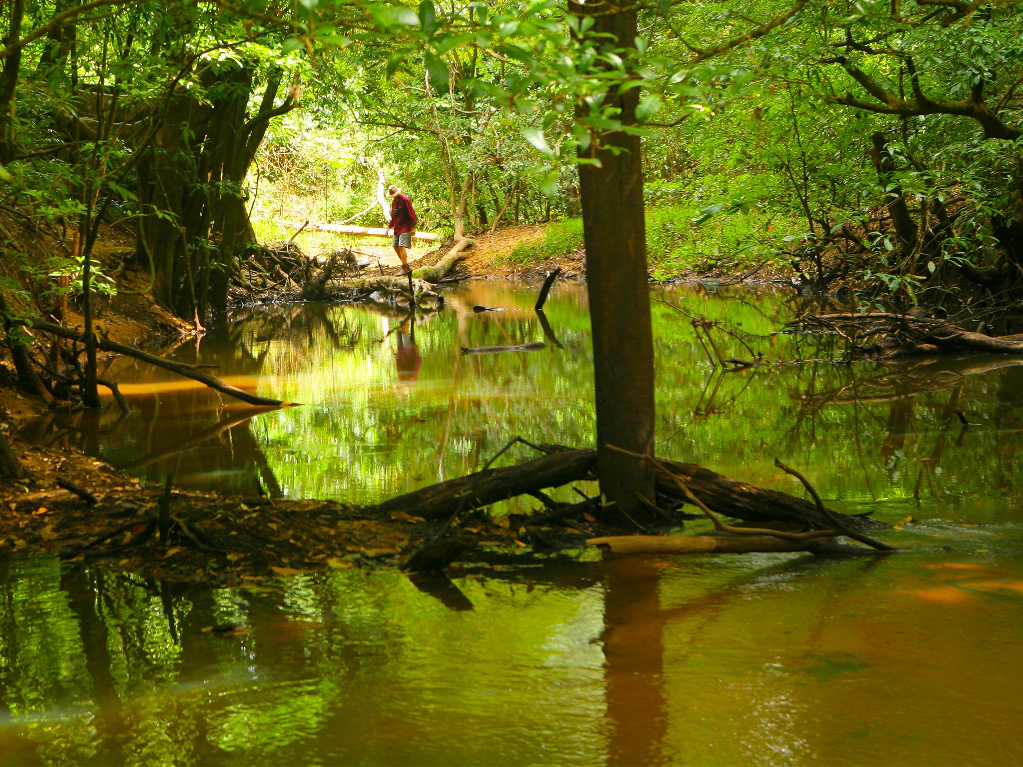
![Travel through rainforest and open woodland along the Claudie River on the Old Coen track.]() Travel through rainforest and open woodland along the Claudie River on the Old Coen track.
Photo credit: © John Augusteyn
Travel through rainforest and open woodland along the Claudie River on the Old Coen track.
Photo credit: © John Augusteyn
-
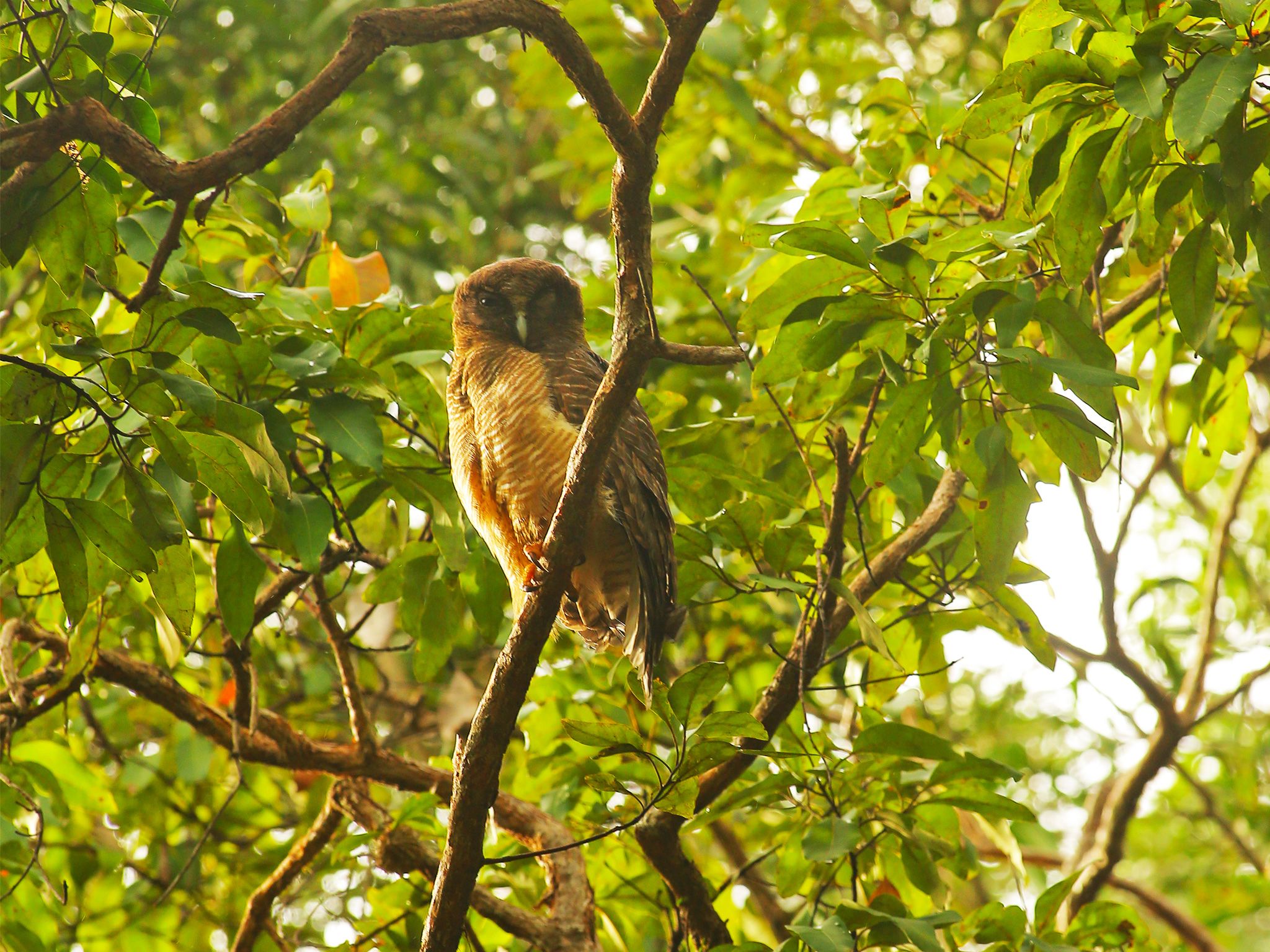
![The Old Coen track offers excellent birdwatching, including the chance to spot a rufous owl.]() The Old Coen track offers excellent birdwatching, including the chance to spot a rufous owl.
Photo credit: © John Augusteyn
The Old Coen track offers excellent birdwatching, including the chance to spot a rufous owl.
Photo credit: © John Augusteyn
-
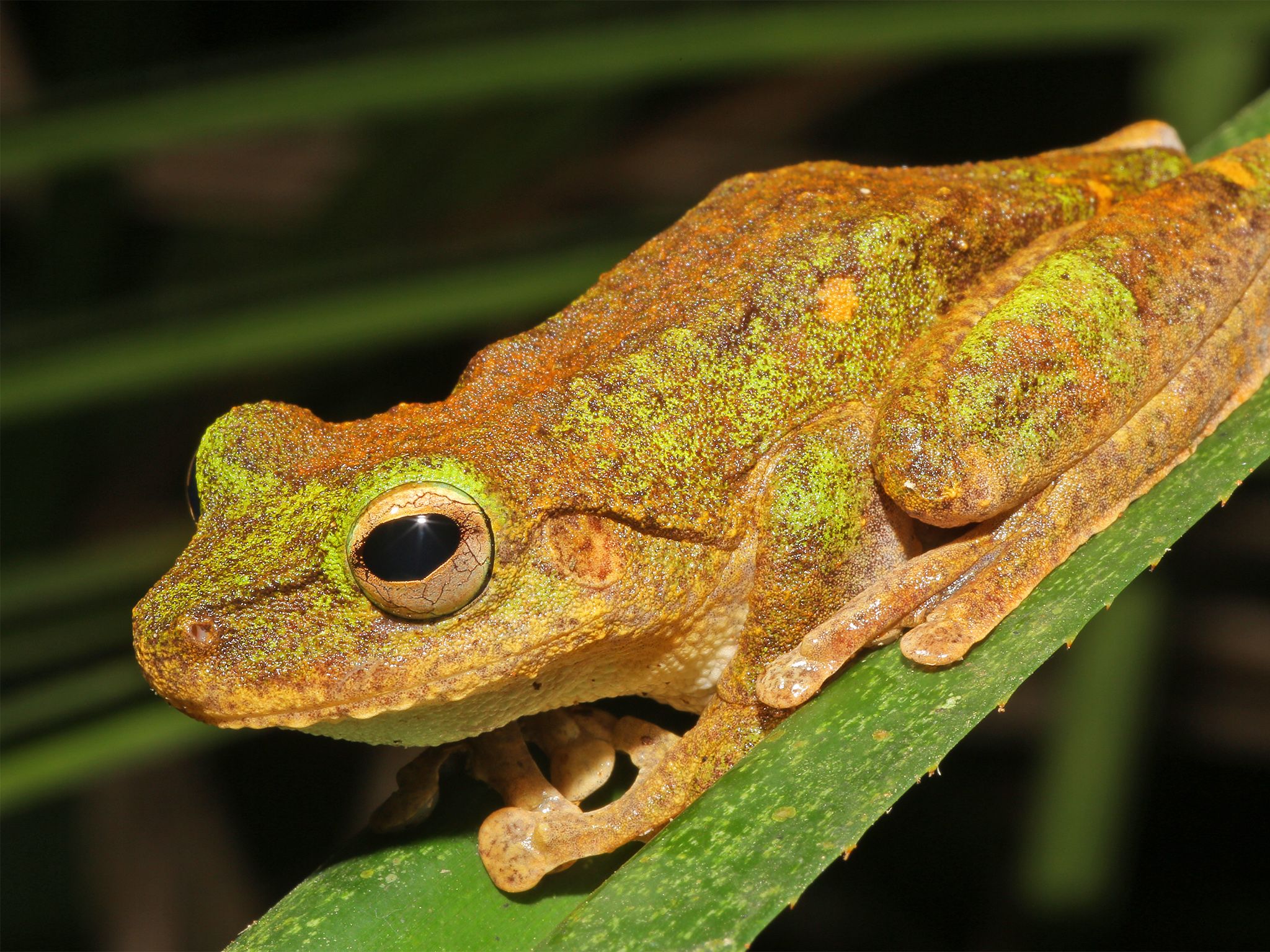
![In the rainforest, keep an eye out for frogs like this growling green eyed frog.]() In the rainforest, keep an eye out for frogs like this growling green eyed frog.
Photo credit: © John Augusteyn
In the rainforest, keep an eye out for frogs like this growling green eyed frog.
Photo credit: © John Augusteyn


Pack your camera and binoculars before you embark on this one-way trek from the Rainforest camping area on the banks of the Claudie River. Relish the excitement of rewarding birdwatching along this track that was once the main road between Portland Roads and Coen. Look for cassowaries and double-eyed fig-parrots. You may also glimpse large black palm cockatoos, raucous eclectus parrots and elusive fawn-breasted bowerbirds. You’re sure to spot the Cape York forms of the Australian brush-turkey, with their surprising mauve (purple) wattles.
Make sure you arrange for a pick-up at the end of the track, where the Portland Roads Road crosses west Claudie River.
Kutini-Payamu (Iron Range) National Park (CYPAL) is jointly managed by the Northern Kuuku Ya'u Kanthanampu Aboriginal Corporation RNTBC Land Trust and the Queensland Government.
Getting there and getting around
The Old Coen track is in Kutini-Payamu (Iron Range) National Park (CYPAL), about 200km north of Coen on Cape York Peninsula.
- From the park entrance, drive 17.9km along Portland Roads Road from the park entrance to the Rainforest camping area and the start of the Old Coen track.
- You can access the park from the south via the Peninsula Developmental Road or from the north via the challenging and unpredictable Frenchmans Track.
- For both routes, you need a high clearance 4WD with recovery gear and extra supplies; and you need to be proficient in four-wheel driving.
- On Frenchmans Track your vehicle also needs a snorkel; and you should be experienced in challenging 4WD conditions.
- If you're towing a trailer, take the Peninsula Developmental Road route; neither route is suitable for towing caravans.
- Alcohol restrictions are in place in many of Queensland's Aboriginal and Torres Strait Islander communities and apply to the towns and areas around Kutini-Payamu (Iron Range) National Park (CYPAL). For the latest information on restrictions, see Community alcohol limits. The camping areas in the park are outside the alcohol restriction zone.
- Read 4WD with care for important information on 4WD safety and minimal impact driving.
Peninsula Developmental Road
Turn off the Peninsula Developmental Road onto Portland Roads Road, 35km north of the Archer River Roadhouse (175km south-west of Weipa), and drive 83km along this well-formed gravel road to the park entrance.
Frenchmans Track
Turn off the Telegraph Road onto Frenchmans Track, 22km south of Moreton Telegraph Station, and drive 52km to the intersection with Portland Roads Road, then turn left onto Portland Roads Road and travel a further 13km to the park entrance.
Wheelchair access
There are no wheelchair-accessible facilities.
Drinking water
- Collect bore water from the roadside tank 1km from Chilli Beach or from a tap at the Iron Range ranger base.
- Treat all water before use.
Before you visit
Opening hours
Old Coen track is open 24 hours a day.
Check park alerts for the latest information on access, closures and conditions.
Seasonal closures
The park may be closed the wetter summer months.
Visiting safely
For more safety information see Visiting Kutini-Payamu (Iron Range) safely and Walk with care.
- There are currently no park alerts for this park.