Rainforest camping area
Relish a peaceful night’s sleep amongst lush lowland rainforest beside the river, and enjoy rewarding birdwatching around your camp.
Accessible by
- 4WD
Camping area facilities
- Campfires allowed (conditions apply)
- Generators allowed (conditions apply)
- Tent camping
- Camper trailer camping
- Tent camping beside car
- Walking
- Scenic drive
-
![Spotlight in the surrounding forest at night for green pythons.]() Spotlight in the surrounding forest at night for green pythons.
Photo credit: Paul Candlin © Queensland Government
Spotlight in the surrounding forest at night for green pythons.
Photo credit: Paul Candlin © Queensland Government
-
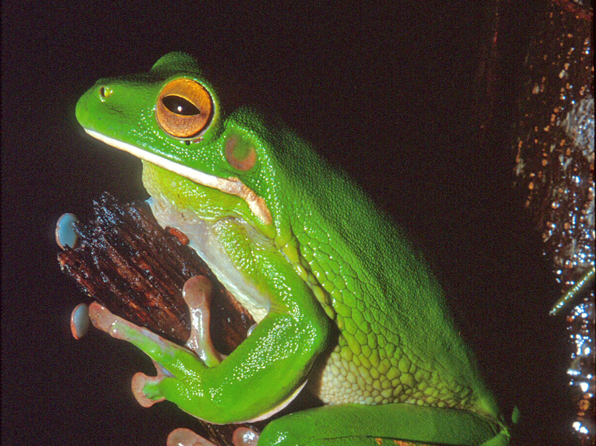
![Relax in your tent and listen to the frog calls, like that of the white-lipped treefrog.]() Relax in your tent and listen to the frog calls, like that of the white-lipped treefrog.
Photo credit: © Queensland Government
Relax in your tent and listen to the frog calls, like that of the white-lipped treefrog.
Photo credit: © Queensland Government
-
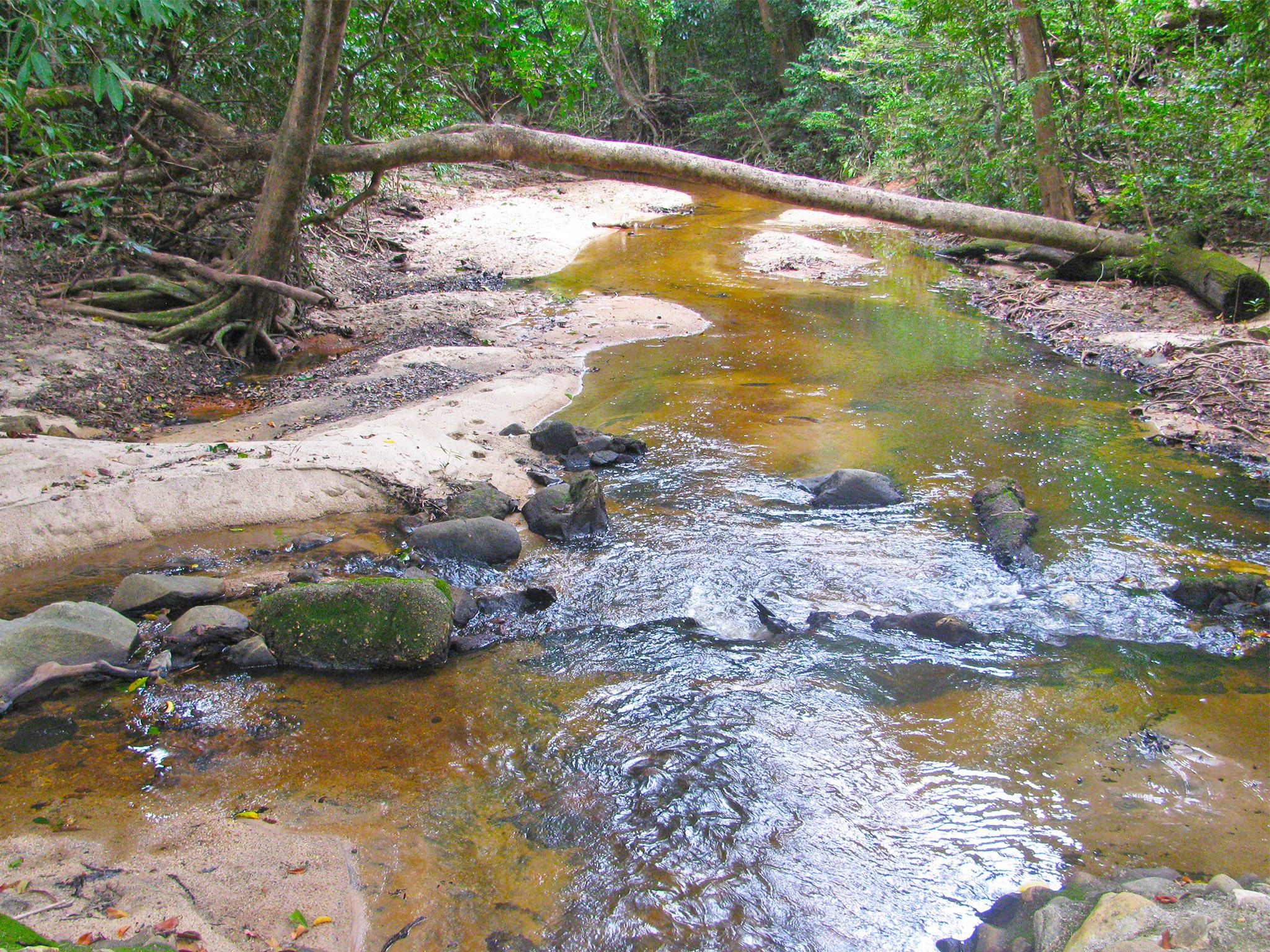
![Quiet, shady camp sites on the bank of the Claudie River await you at the Rainforest camping area.]() Quiet, shady camp sites on the bank of the Claudie River await you at the Rainforest camping area.
Photo credit: © John Augusteyn
Quiet, shady camp sites on the bank of the Claudie River await you at the Rainforest camping area.
Photo credit: © John Augusteyn
-
![Rainforest camping area near the Claudie River offers a cool oasis.]() Rainforest camping area near the Claudie River offers a cool oasis.
Photo credit: Russel Edwards © Queensland Government
Rainforest camping area near the Claudie River offers a cool oasis.
Photo credit: Russel Edwards © Queensland Government
-
![Share your camp site with nocturnal animals like this southern common cuscus.]() Share your camp site with nocturnal animals like this southern common cuscus.
Photo credit: John Augusteyn © Queensland Government
Share your camp site with nocturnal animals like this southern common cuscus.
Photo credit: John Augusteyn © Queensland Government
-
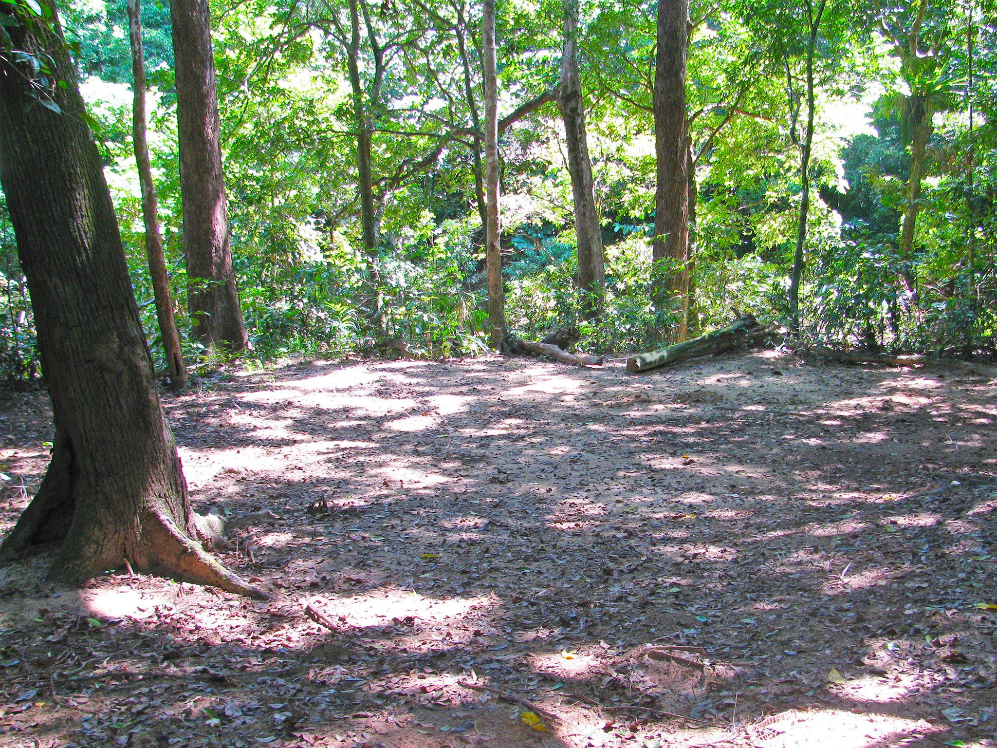
![The Rainforest camping area has shady, sheltered camp sites.]() The Rainforest camping area has shady, sheltered camp sites.
Photo credit: Russel Edwards © Queensland Government
The Rainforest camping area has shady, sheltered camp sites.
Photo credit: Russel Edwards © Queensland Government


Always check
- Park alerts for the latest information on access, closures and conditions.
- Bureau of Meteorology weather forecasts.
- Current bushfire warnings and incidents and also fire bans and restrictions.
- Your camping permit is booked.
- Any park-specific camping information for
Kutini-Payamu (Iron Range).
- Visiting Kutini-Payamu (Iron Range) safely for important safety information.
The self-service kiosk at this park has been decommissioned.
Visitors need to book their camping permit before they visit. Book online, at an over-the-counter booking office or by phone.
Relax around your shady camp site in rainforest on the banks of the Claudie River at this popular camping area, suitable for high-clearance camper trailers as well as tents.
Indulge many happy hours wildlife spotting here. Sit quietly, and well back, from the river bank and spot the resident crocodile. Grab your binoculars and watch the many different birds of the rainforest. You may even see a cassowary! In the evenings, walk quietly and spotlight for common spotted cuscus and green pythons—listen for rustling leaves and look for eye shine. Later, swap stories around the camp fire.
Kutini-Payamu (Iron Range) National Park (CYPAL) is jointly managed by the Northern Kuuku Ya'u Kanthanampu Aboriginal Corporation RNTBC Land Trust and the Queensland Government.
Getting there and getting around
The Rainforest camping area is in Kutini-Payamu (Iron Range) National Park (CYPAL), about 200km north of Coen on Cape York Peninsula.
- From the park entrance, drive 17.9km along Portland Roads Road to this camping area.
- You can access the park from the south via the Peninsula Developmental Road or from the north via the challenging and unpredictable Frenchmans Track.
- For both routes, you need a high clearance 4WD with recovery gear and extra supplies; and you need to be proficient in four-wheel driving.
- On Frenchmans Track your vehicle also needs a snorkel; and you should be experienced in challenging 4WD conditions.
- If you're towing a trailer, take the Peninsula Developmental Road route; neither route is suitable for towing caravans.
- Alcohol restrictions are in place in many of Queensland's Aboriginal and Torres Strait Islander communities and apply to the towns and areas around Kutini-Payamu (Iron Range) National Park (CYPAL). For the latest information on restrictions, see Community alcohol limits. The camping areas in the park are outside the alcohol restriction zone.
- Read 4WD with care for important information on 4WD safety and minimal impact driving.
Peninsula Developmental Road
Turn off the Peninsula Developmental Road onto Portland Roads Road, 35km north of the Archer River Roadhouse (175km south-west of Weipa), and drive 83km along this well-formed gravel road to the park entrance.
Frenchmans Track
Turn off the Telegraph Road onto Frenchmans Track, 22km south of Moreton Telegraph Station, and drive 52km to the intersection with Portland Roads Road, then turn left onto Portland Roads Road and travel a further 13km to the park entrance.
Before you visit
Opening hours
Rainforest camping area is open 24 hours a day. Check-in to your camp after 2pm and check-out by 11am on the day of departure.
Check park alerts for the latest information on access, closures and conditions.
Seasonal closures
The park may be closed during the summer wet months.

Site two, Rainforest camping area.
Photo credit: Gary Featonby, Queensland Government
Camping area features
- Features: a shady and sheltered area in the rainforest on the bank of the Claudie River—a great spot for birdwatching.
- Location: near the start of the Old Coen walking track, just off Portland Roads Road.
- Map: Rainforest, Cooks Hut and Gordon Creek camping areas map
- Access: the camping area can be reached by four-wheel-drive vehicles only.
- Number of sites: three numbered sites. Camp sites are very popular during peak periods. Campers should plan their visit and obtain an e-permit well in advance.
| Site | Maximum vehicles | Maximum people | Site dimensions |
|---|---|---|---|
| 1 | Two cars and trailers. | 12 | 14m x 16m |
| 2 | One car (not suitable for trailers). | 6 | 7m x 12m |
| 3 | Two cars (not suitable for trailers). | 12 | 13m x 13m |
- Camp sites are suitable for: tent camping beside your car and camper trailers (site one only).
- Camp site surface: dirt.
- Shade: all sites are shady and sheltered.
- Facilities: none. A hybrid toilet is located at Cooks Hut camping area (about 900m away).
- Open fires: allowed (except when fire bans apply) in existing fireplaces only. Fuel stoves recommended.
- Generators: generators that operate at a noise level less than 65dB(A) at 7m are permitted between 8am and 7pm only.
- Essentials to bring: adequate food and drinking water, equipment for treating water, rubbish bags, insect repellent, screened tents or mosquito nets, a fuel stove and adequate fuel and spare parts for your vehicle. Read more about before you visit.
- Bookings: book online or by phone prior to arrival. Camp sites are very popular during peak periods. Campers should plan their visit and obtain an e-permit well in advance.
- Mobile phone coverage: not available.
Upcoming camping area availability
Visiting safely
For more safety information see Visiting Kutini-Payamu (Iron Range) safely and camp with care.
- There are currently no park alerts for this park.