Steamer Creek remote bush camp
Follow an old snig trail to this quiet camp site in regrowth forest close to sheoak-lined Steamer Creek.
Accessible by
- Walk-in
Camping area facilities
- Tent camping
- Long walk to tent
- Walking
-
![Look for gloss black-cockatoos as you pass through the sheoak forest.]() Look for gloss black-cockatoos as you pass through the sheoak forest.
Photo credit: © John Augusteyn
Look for gloss black-cockatoos as you pass through the sheoak forest.
Photo credit: © John Augusteyn
-
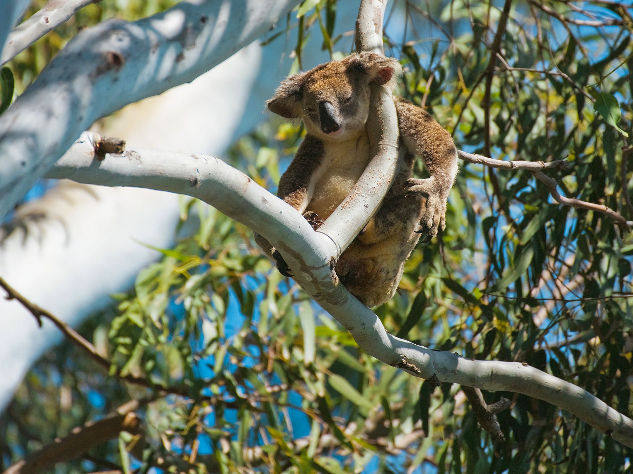
![Koalas rest high in the branches of eucalypt trees.]() Koalas rest high in the branches of eucalypt trees.
Photo credit: Ezra Patchett © Tourism and Events Queensland
Koalas rest high in the branches of eucalypt trees.
Photo credit: Ezra Patchett © Tourism and Events Queensland

Always check
- Park alerts for the latest information on access, closures and conditions.
- Bureau of Meteorology weather forecasts.
- Current bushfire warnings and incidents and also fire bans and restrictions.
- Your camping permit is booked.
- Any park-specific camping information for
Main Range.
- Visiting Main Range safely for important safety information.
If you’re an experienced off-track walker with specialist equipment and well-developed navigational skills, then the walk to this remote camp site is for you.
Follow a fire trail and then an old snig track deep into the forest. Think back to a time when bullock teams, and then tractors, used this road to haul logs from the valley. The forest is much quieter now, and has slowly regenerated over the ensuing decades.
Once you’ve pitched your tent, look for glossy black-cockatoos feeding in the sheoaks along the creek. These birds only eat the seeds of a few sheoak species, making them one of the most highly-specialised birds in the world.
This park is part of the Gondwana Rainforests of Australia World Heritage Area, famed for its ongoing geological processes, evolutionary history, and diversity (especially of rare, threatened and endemic species).
Getting there and getting around
Steamer Creek remote area bush camp is in Main Range National Park, about 120km south-west of Brisbane.
Before preparing to walk to remote camping areas, walkers should consider their experience and preparedness levels. A high level of physical fitness and navigational skills are essential.
- Plan to walk safely and be responsible.
- Familiarise yourself with the area before attempting an extended walk.
- Check park alerts for the latest information on access, closures and conditions.
- Research the route thoroughly and get local advice. Recommended maps for bushwalking are 1:25,000 topographic maps. It is also advisable to carry a recognised guidebook for the area.
- Carry good navigation and communication gear.
- Complete a bushwalking advice form and leave your plan with a responsible person.
- Contact your local walking club or Bushwalking Queensland for further information.
Camping permits are essential.
Before you visit
Opening hours
Steamer Creek remote area bush camp is open 24 hours a day. Check-in to your camp after 2pm and check-out by 11am on the day of departure.
Check park alerts for the latest information on access, closures and conditions.
Camping area features
Grassy, open forest site, south of Steamer Creek. This is primarily intended as an overnight site for bushwalkers undertaking extended walks into the Main Range.
Location: Approximately 250m east of the locked gate on the Steamer Creek fire trail. Map Sheet: Mount Superbus 9341-12. Grid Reference: 429 805. GPS Reference: 56J 0442996 6880505 (GDA 94).
Access: Nearest vehicle access is by 4WD via Emu Creek Road, Old Mill Road and the Steamer Creek fire trail, or by 2WD in dry weather via Emu Creek Road to the start of Old Mill Road, east of Emuvale.
Number of sites: Open area without separately-defined sites. Maximum of 8 people.
Camp sites are suitable for: self-sufficient, walk-in camping.
Camp site surface: Grass.
Facilities: None. Must be self-sufficient. Water collected from creeks should be treated before drinking. All rubbish (including food scraps) must be carried out.
Open fires: Prohibited. Use fuel stoves only.
Generator use: Not allowed.
Essentials to bring: Drinking water, extra food, first-aid kit, topographic map, compass, torch, warm clothing, wet weather gear, rubbish bags, insect repellent, fuel or gas stove and a small trowel for burying human waste. Read more about before you visit.
Bookings: book online or learn about our camping booking options.
Mobile phone coverage: Poor.
Upcoming camping area availability
Visiting safely
For more safety information see Visiting Main Range safely and camp with care.
- Main Range National Park - Cunninghams Gap section walking track closures 7 February to 5 May 2024
- Roadworks at Cunninghams Gap - Mount Mitchell track temporarily realigned 10 November 2023 to 31 July 2024